Liked the post? Subscribe in Reader
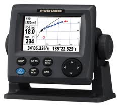
Here are producers that produce GPS devices.

Keywords you can use to search for this article :
1.Garmin Ltd
Garmin is famous for GPS users. These firms have a lot to produce GPS navigation to the ordinary consumer and industrial products from Garmin penerbangan.produk has been widely used to navigate to the cars, bicycles, boats, fishing and other recreational purposes.2.TomTom Inc
TomTom Inc. comes from the Netherlands. TomTom has been marketing its products to various countries. This company has a superior product in the form of GPS navigation software and a special device mounted on PDA devices and Pocket PCs. In addition, the TomTom inc is one of the major GPS manufacturers who market GPS devices to be connected in the car. TomTom also supply mobile GPS to your smart phone industry.
3.Thales Navigation
Thales Navigation is a GPS systems provider vendor for the corporat (professional) and the general public. Thales Navigation has 2 big brand. For general among them using the name Magellan GPSnya product to market. in general the GPS Thales provides solutions for the automotive and recreation markets. As for the corporat they use the name of Thales Navigation. By providing service in handling the survey, GIS / Mapping, and OEM products.4.Magellan
Magellan GPS products for the consumer is from Thales Navigation (see above).5.Trimble
Trimble provides GPS navigation solution for an integrated model.6.Lowrance Electronics Inc
Lowrance Electronics is a manufacturer of GPS has made GPS device for the purposes of development of marine, aviation outdoor, and automotive GPS solutions as well as OEM products.7.Navman
Navman comes from the company's garage from New Zeeland, Navman has grown into a global enterprise provider of GPS technology. Navman GPS provides solutions for marine, in-car, wireless, sports and commercial use.8.Alk Technologies Inc
ALT Technologies not only as a provider of GPS navigation systems. Alk provides routing, mileage and mapping solutions for shipping companies, private fleets and logistics company. Alk Technologies Inc also provides a decision support system for the main railway in the U.S.. In addition, these companies also provide container tracking and management system for marine transportation companies and barge operators.9.Cobra Electronics Corporation
Cobra has a great reputation as a leading manufacturer GMRS / FRS two-way radio, radar detector technology. But now the cobra has created innovative new markets to promote GPS in mobile navigation and marine areas.10.DeLorme
Originally a publishing company Atlas DeLorme, DeLorme has been a pioneer in the field of GPS mapping software and technology for both professional and consumer markets. DeLorme has the advantage in the manufacture of mapping software and geographic information systems. This company has a variety of GPS solutions for laptops, PCs Palm and Pocket PC, and handheld GPS units.Keywords you can use to search for this article :
- Vendors supplier GPS Receiver
- Producers manufacture GPS Receiver
- How to get GPS Receiver
- 10 Best Vendor of GPS makers