Browse »
Beranda » Artikel Pada Kategori GPS navigation
To create an application vehicle tracking using GPS was not too difficult. You now do not have to worry to prepare maps. You also do not need to prepare a program that serves as GPS Navigation. Because there is now a free application that helps you in making a GPS vehicle tracking. These applications are called Cetus GPS. Cetus GPS provides a shortcut to your current position, course, speed, altitude, time and statistical information.
For Information, Cetus GPS can be used in Garmin Nuvi, Magellan GPS, TomTom GPS, GPX and Navit.
Free Download : Cetus GPS
Source :
mapcruzin
iPhone developer has been made a GPS navigation which you can download for free. The GPS Apps called Free GPS. So you do not need to visit the iPhone store to get this GPS application. Free GPS provides the required functionality to make use of the iPhone's built-in GPS inside a simple clean interface. Should you connect the latitude and longitude, Free Gps navigation will assist you for your destination.
To use the free GPS is easy. You simply tag locations fairly easily by hitting “Make Present Position New WayPoint.” You may also type in a WP manually.
This GPS app has a size of 0.3 MB. Free GPS can be installed on iPhone, iPod touch, and iPad.Requires iOS 5.0 or later. Now, the Free Gps comes with a version 2.0. Let’s quickly run this application. To
download Free GPS, please visit
itunes.apple.com.
Source :
makeuseof
Motorola Xoom is a mobile-based android using GPS navigation facility. The Motorola Xoom is full of Assisted Global Positioning System (A-GPS). A-GPS allows the system improved TTFF (Time to First Fix) or initialization time. This design works with the current configuration of 3G, and can only be reached faster when it comes to upgrade.

This mobile phone recognized Google Maps 5 as a form of navigation that works in conjunction with A-GPS and compass magnetometer. Google Maps 5 allows users to navigate through an environment in three dimensions using the touch screen capabilities available under the Motorola Xoom screen saver. These features allow a user to not only follow the instructions on the way to a destination, but knowing the destination in sight, simply using the top navigation tools, secreted in the box Motorola Xoom. With a complete package of hardware and software for GPS navigation applications, the Motorola Xoom has great potential. One of the most interesting to see how their market share continues to grow is how these tools to use their potential. Many of them have been integrated into the design in the hope of greater utility in the future.
Source :
mygadgets99 |
dailyhealthstore
This is a information about How to Know the Coordinates to a GPS Receiver posted by Unknown at 8:20 AM, Thursday, February 10, 2011. Tag : compass,converter,Decimal Degrees,GPS Devices,GPS navigation,GPS Receiver,latitude,longitude,NMEA,UTM - No comments
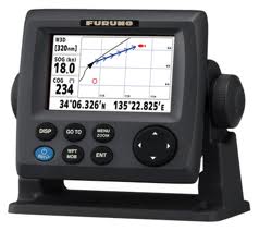
GPS navigation is very helpful in the process. We can find the coordinates of an object by using GPS. GPS replaces compass function in determining the direction of where we are heading. We do not have great difficulty when we travel. By using GPS, we can determine our position and the position of our goals.
Position data is displayed in the format of latitude and longitude. Position latitude and longitude will change when the vehicle's position also changes.
Latitude and longitude information can be displayed with various shapes, including
Decimal Degrees (WGS84)
Latitude Longitude
37.391933 -122.04375
Degrees, Minutes & Seconds
Latitude Longitude
N37 23 30 W122 02 37
GPS
Latitude Longitude
N 37 W 122 23 516 02 625
UTM
X Y
10N 584 646 4,138,781
The above data is GPS Coordinate Converter, Maps and Info.
In general, the latitude and longitude information displayed by GPS format. These data are NMEA data obtained from satellites. To convert the format of GPS in another form, you can visit
boulter and
itouchmap
 Liked the post? Subscribe in Reader