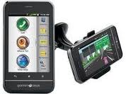
GPS 3D Aura for Samsung Galaxy S

3D GPS Aura is android based applications that can assist in the process of tracking your travels. Aura 3D GPS is not just an ordinary GPS application, the application is equipped with 3D features. This android apps development is Sygic Aura. Sygic Aura is the developer of applications for car navigation.

GPS 3D Aura for Samsung Galaxy S


You can use GPS 3D Aura for Samsung Galaxy S. The size of the GPS 3D Aura only 3.31 MB. Enjoy some of the features on the Samsung Galaxy S. Such features include :
  1. Turn-by-turn car navigation with voice guidance
  2. Latest TomTom maps stored on the phone
  3. Free map updates until January 2012
  4. Free speed limit, speed camera and points of interest updates
  5. 3D view of cities and landscape
  6. Real-Time Traffic Europe and Australia (available as a subion service at www.sygic.com/shop)
  7. Multi-stop route planning with interim destinations
  8. Road incident sharing and real-time notifications
  9. Speed camera and speed limit display and audio warning
  10. Lane Assistant and signposts
  11. Traveled routes statistics and altitude profiles in Travel Book
  12. High Resolution display
  13. Automatic resolution adaptation
  14. Multitasking
  15. Hardware accelerated 3D rendering
  16. Car audio integration using Bluetooth or cable
  17. Automatic screen rotation using accelerometer
  18. Compass-assisted direction detection
  19. Multitouch support for easier map browsing
  20. Intuitive interaction with points of interest
  21. City guides from premium providers and from Wikipedia
  22. Friends on the map
  23. Facebook sharing of geo-tagged statuses
  24. Vote for new features at feedback.sygic.com
  25. Unlimited license at sygic.com/shop
  26. Map coverage at sygic.com/android/maps
  27. Compatibility at sygic.com/aura/list/

Source : mobile9

10 Best Vendor of GPS makers

Here are producers that produce GPS devices.
1.Garmin Ltd
Garmin is famous for GPS users. These firms have a lot to produce GPS navigation to the ordinary consumer and industrial products from Garmin penerbangan.produk has been widely used to navigate to the cars, bicycles, boats, fishing and other recreational purposes.

2.TomTom Inc
TomTom Inc. comes from the Netherlands. TomTom has been marketing its products to various countries. This company has a superior product in the form of GPS navigation software and a special device mounted on PDA devices and Pocket PCs. In addition, the TomTom inc is one of the major GPS manufacturers who market GPS devices to be connected in the car. TomTom also supply mobile GPS to your smart phone industry.


3.Thales Navigation
Thales Navigation is a GPS systems provider vendor for the corporat (professional) and the general public. Thales Navigation has 2 big brand. For general among them using the name Magellan GPSnya product to market. in general the GPS Thales provides solutions for the automotive and recreation markets. As for the corporat they use the name of Thales Navigation. By providing service in handling the survey, GIS / Mapping, and OEM products.

4.Magellan
Magellan GPS products for the consumer is from Thales Navigation (see above).

5.Trimble
Trimble provides GPS navigation solution for an integrated model.

6.Lowrance Electronics Inc
Lowrance Electronics is a manufacturer of GPS has made GPS device for the purposes of development of marine, aviation outdoor, and automotive GPS solutions as well as OEM products.

7.Navman
Navman comes from the company's garage from New Zeeland, Navman has grown into a global enterprise provider of GPS technology. Navman GPS provides solutions for marine, in-car, wireless, sports and commercial use.

8.Alk Technologies Inc
ALT Technologies not only as a provider of GPS navigation systems. Alk provides routing, mileage and mapping solutions for shipping companies, private fleets and logistics company. Alk Technologies Inc also provides a decision support system for the main railway in the U.S.. In addition, these companies also provide container tracking and management system for marine transportation companies and barge operators.

9.Cobra Electronics Corporation
Cobra has a great reputation as a leading manufacturer GMRS / FRS two-way radio, radar detector technology. But now the cobra has created innovative new markets to promote GPS in mobile navigation and marine areas.

10.DeLorme
Originally a publishing company Atlas DeLorme, DeLorme has been a pioneer in the field of GPS mapping software and technology for both professional and consumer markets. DeLorme has the advantage in the manufacture of mapping software and geographic information systems. This company has a variety of GPS solutions for laptops, PCs Palm and Pocket PC, and handheld GPS units.

Keywords you can use to search for this article :


Building a Diversion of the Vehicle Monitoring Application - part 1

In this article createonlinemap try to give examples of applications created by utilizing the GPS receiver module. The application was given the name of the vehicle monitoring application fraud. The application monitors the vehicle fraud is web-based application that serves to monitor the presence of a moving vehicle, so that can determine whether the vehicle was used as appropriate or not. Move in the understanding of geography is the transfer point of view position coordinates to the coordinates of one another. Applications stored on web servers which serves as a GPS Tracking Server. Computer monitors will connect to the web server address to be able to position objects.


Applications built using the digital map display which is taken from Google Map. Map Google Map is our program through the API (Application Programming Interface) available to display objects that represent position of moving objects / GPS Tracking Device. Object position information taken from the MySQL database where the data is always updated by GPS Tracking Device periodically. As a result we will have the effect of moving each time we refresh the data and displays it on the map Google Map. Vehicles are considered perverted if:
  1. Vehicles exit the work area that has been determined.
  2. Vehicle speed exceeds the maximum speed limit that has been determined by the agency / company concerned.
  3. Vehicles used outside working hours the company / institution.To find out vehicles that deviate from the work area that has been determined by the company / agency, the necessary features geofencing.
Geofencing (restriction area) was used to analyze the position of vehicle automatically and report the vehicle when the exit or entrance area geofence previously been determined by the user. Areas such geofence is a virtual area that limits a particular location. To find a vehicle outside or in any area used mathematical formulas geofence.


0 = c + bx + ax2
 

For articles on geofencing can be seen in a later article. A simple example application monitoring and diversion of official vehicles you can see here.


Keywords you can use to search for this article :

Cheap GPS from Kogan Technologies EziNav

GPS with this minimalist feature called Kogan Technologies EziNav. You can get this GPS at an affordable price. Although the price is cheap but that does not mean that these products in the category of cheap goods.

Kogan Technologies EziNav casing made ​​of plastic material. By using this gadged manufacturer of plastic materials can lower the production cost for this gadget could be marketed to consumers with cheap price. But clearly this does not lower the casing quality standard features that must be owned by a guide-way devices. Standard features that must be owned by the gadget guide direction is peed camera alerts, Bluetooth, and the ability to play multimedia files. Regarding the bluetooth connectivity features, this EziNav works well too. The quality of sound devices, when used as a handsfree pretty decent, although still sounding a little buzz.


With a width of 4.5 inches touch screen and menu system fairly easy. EziNav This work uses SiRF Atlas-III processor that is able to present the performance of GPS that is reliable for day-to-day operation. And it was proven on quite quickly and accurately capture signals by satellite navigation devices. Of the dead, only takes about 3 minutes for it until ready to use GPS to find locations. With the price of U.S. $ 170 you can get the guide direction of technology from Kogan.

In brief, the features of Kogan Technologies EziNav are as follows:
  • Type: GPS
  • Processor: SiRF Atlas-III
  • Memory: 64 MB + Secure Digital (SD)
  • Operating System: Windows CE
  • Display: 4.5 in TFT touchscreen
  • Interface: Headphone Jack, USB 2.0
  • Dimensions: 22 x 125 x 83mm
  • Other Features: MP3 Player, Bluetooth
  • More information about Kogan Technologies EziNav can be found here.

Keywords you can use to search for this article :

Weaknesses held GPS

In the previous article have been discussed about the usability of GPS and its superiority. In the present article will discuss the weaknesses that are owned by this monitoring device. By knowing the weaknesses in the GPS device, then we can optimize the functionality and usability of GPS. Among the weaknesses are as follows :

The first weakness is owned GPS endanger other countries. State geographic easily monitor other countries, it is possible to conduct a military strike. For example, dropping a missile right at the base of a country. Location certainly is a military base can be known through GPS system.

dangerous of GPS

The second reduction in privacy. Users of vehicles equipped with GPS will always know where he had gone. So also is experienced by users of mobile phones with GPS systems. For most people, this is quite disturbing and troubling.


GPS can invited crime. Most Indonesian people still consider a GPS device as an object which is expensive. No wonder, for those who intend evil, a device like this can invite crime.

The fourth is the GPS can be dangerous to the driver of the vehicle.
GPS can indeed be used as a guide when he was on the highway, but it makes the driver's vehicle is out of focus and concentration is broken. Risk of any accident could happen. Often the lack of valid information in the GPS so that the actual road conditions with the condition of roads in different GPS.

Keywords you can use to search for this article :

GPS for Mountain Bikes

You have a hobby of using a mountain bike adventure. You sometimes get lost during an adventure which is caused by not knowing the direction. Do not be confused, it turns out there are tools that can assist you in an adventure that you lost. Device is GPS Bike. According showbikers GPS Bike can be installed easily.

Installation is easy to make GPS Bike Tracker as your bicycle accessories. GPS Bike Tracker has internal GPS and GSM antenna. Taking advantage of tracking features and stop engines for motorcycles, this device can capture the signal GPS / GSM / GPRS network.


Here are the features that are owned by GPS Bike Tracker :
  1. Chipset SiRF Star III / JRC Chipset, reliable to know the position even in areas with a weak GPS signal though. Works well in bad weather conditions.
  2. Module GSM / GPRS, supports dual or quad-band GSM 900/1800 MHz (850/1900 Optional)
  3. Support SMS and GPRS TCP connection.
  4. Get the coordinates via the handphone SMS, or login to the server for tracking via GPRS.
  5. Portable, small size. Power consumption is small, automatically turn off the GPS in a state of silent vehicles more than 5 minutes (sleep mode)
  6. Turn off the machine with SMS commands.
  7. There is a spare battery, lasted 5 hours after release from the power supply vehicle
  8. Automatic detection of key contacts on, stop charging the battery when the vehicle stops. Make the battery last longer.
More information about GPSbike can be found here.

Keywords you can use to search for this article :

Know better the inventor of the GPS?

After 30 years of GPS satellite launches into space. Lots of changes obtained after the launch mission. The world that earlier use of technology in determining the direction of the compass. Now the world made easy with the GPS technology, so no need to confusion in determining the direction. In addition, many other uses are obtained from GPS. Examples such as can detect ground measurements that are down in the area Porong, Sidoarjo, Indonesia.

But you know, who the inventor of guiding this remarkable direction. The inventor of this tool is Ivan Getting and Brad Parkinson. They also lead in the discovery of this powerful tool. Here's a brief biography of them both:

Ivan A. Getting was born on 18 January, 1912 in New York City to family of Slovak immigrants from Bytča, Slovakia and grew up in Pittsburgh, Pennsylvania. He attended the Massachusetts Institute of Technology (MIT) as an Edison Scholar (S.B. Physics, 1933); and Oxford University as a Graduate Rhodes Scholar (D.Phil., 1935). He then worked at Harvard University on nuclear instrumentation and cosmic rays (Junior Fellow, 1935-1940) and the MIT Radiation Laboratory (1940-1950; Director of the Division on Fire Control and Army Radar, Associate Professor 1945; Professor 1946). During the Second World War he was a special consultant to Secretary of War Henry L. Stimson on the Army’s use of radar. He also served as head of the Naval Fire Control Section of the Office of Scientific Research and Development, member of the Combined Chiefs of Staff Committee on Searchlight and Fire Control, and head of the Radar Panel of the Research and Development Board of the Department of Defense.he was getting involed in world War 2.

In 1950, during the Korean War, Getting became Assistant for Development Planning, Deputy Chief of Staff, United States Air Force; and in 1951, Vice President for Engineering and Research at the Raytheon Corporation (1951-1960). While at Raytheon, Getting also served on the Undersea Warfare Committee of the National Research Council.

In 1960 Getting became founding President of The Aerospace Corporation (1960-1977). The Corporation was established at the request of the Secretary of the Air Force as a non-profit organization to apply "the full resources of modern science and technology to the problem of achieving those continued advances in ballistic missiles and space systems, which are basic to national security." Getting was also a founding member of the Air Force Scientific Advisory Group (later renamed the Scientific Advisory Board) and chair of its Electronics Panel. In 1978 he served as President of the Institute of Electrical and Electronics Engineers. He served on the Board of Directors of the Northrop Corporation and the Board of Trustees of the Environmental Research Institute of Michigan.Getting retired from The Aerospace Corporation in 1977, and died on October 11, 2003, in Coronado, California (more info)


While the biographies of  Bradford Parkinson (February 16, 1935) is an American engineer and inventor, and United States Air Force colonel best known as the father of the Global Positioning System.

He attended the United States Naval Academy, graduating in 1957, but decided to join the Air Force because of its superior educational opportunities. Parkinson then attended the Massachusetts Institute of Technology for his M.S. in Aeronautics, graduating in 1961.

After several years in the Air Force, he entered a Ph. D. program at Stanford University, graduating in 1966. In 1973 he became manager of the NAVSTAR GPS development program, where he remained until 1978 when he retired from the Air Force. In 1984, Parkinson became a professor at Stanford University, where today he is a professor emeritus.

In 2003 he shared the Draper Prize with Ivan A. Getting for his contributions to the invention of the Global Positioning System. In 2004 he was inducted into the National Inventors Hall of Fame. Today Parkinson lives in San Luis Obispo, California near his six children and five grandchildren (more info). That story may be useful...thank's

Keywords you can use to search for this article


How to Know the Coordinates to a GPS Receiver


GPS navigation is very helpful in the process. We can find the coordinates of an object by using GPS. GPS replaces compass function in determining the direction of where we are heading. We do not have great difficulty when we travel. By using GPS, we can determine our position and the position of our goals.

Position data is displayed in the format of latitude and longitude. Position latitude and longitude will change when the vehicle's position also changes.

Latitude and longitude information can be displayed with various shapes, including


Decimal Degrees (WGS84)
Latitude Longitude
37.391933 -122.04375

Degrees, Minutes & Seconds
Latitude Longitude
N37 23 30 W122 02 37

GPS
Latitude Longitude
N 37 W 122 23 516 02 625

UTM
X Y
10N 584 646 4,138,781

The above data is
GPS Coordinate Converter, Maps and Info.
In general, the latitude and longitude information displayed by GPS format. These data are NMEA data obtained from satellites. To convert the format of GPS in another form, you can visit boulter and itouchmap


Garmin Asus Nuvifone M10-Smart3 latest technology

Garmin mobile phone producer in early 2011 Asus has just announced a new smartphone product. Smart Phone all in one touch screen was named Garmin-Nuvifone Asus M10. Garmin According to Asus, the product of this new smartphones to stay connected to all users at any time through business and personal contacts, email, calendar and IM capabilities are used. This new handset is available in Asian markets and Europe in the early mid-2010.


Benson Lin who now serves as vice president and general manager of ASUS 'Personal Mobile Devices Business Unit, Handheld Business Group, said that the presence of Garmin Asus M10 is in response to public demand for a balance between life and work. Nuvifone M10 smartphone is ideal for business travelers. In addition, this device also has an intelligent navigation capabilities, a comprehensive social networking features, and services to connect that allows its users to promote a lifestyle that is really smart. Garmin Asus M10 is a phone to Smart3 new era. Coupled with some powerful features that can accommodate the needs ponsel, laptops, PNDs and digital cameras.


Garmin Nuvifone, Asus M10 has had the ability to navigate like a GPS Receiver. Advanced navigation features equivalent of a high-end Garmin like help crossing paths with the view that guides the driver into the correct lane for the approaching turn or exit and display signs in a realistic way. This feature also has the highway mode that tells the driver three-way exit to come so that they can plan in advance. The device is ready for another vehicle navigation, and it covers all the needs of the customer to use the device in the car.(Source: http://www.beritateknologi.com)

This latest device specification is as follows:
Display 3.4-inch WVGA touch screen, 512MB RAM and 512MB ROM, 4GB flash memory, Wi-Fi (802.11 b / g), HSDPA wireless connectivity, an intuitive 3D Task Manager, as well as Billboard features which bring important information to display. Not clear about the existence of 500mAh battery that can last how long when used. And there is also the ability to synchronize to Microsoft Exchange so that someone can take care of your contacts, calendar, email security and availability at all times, as well as social networking features and a 5 megapixel camera with geotagging capabilities.

DVD USB SD Bluetooth GPS for Car

DVD USB SD Bluetooth GPS is suitable for use in ordinary cars and car output of Chinese products. This type of GPS is equipped with 7 Inch Car DVD with 800 x 480 - USB TV iPod Bluetooth GPS. GPS CR023033G model is sold at U.S. $ 321.90 (one year warranty). DVD USB SD Bluetooth GPS has a specification.


  • Discs/Formats Played: DVD, CD, VCD
  • Operation: Touch screen or remote control
  • Size Standard: 1-DIN
  • Display Information
          -Screen: 7 Inch LED
          -Aspect Ratio: 16:9
          -Resolution: 800 x 480
          -Brightness: 300 cd/m2
          -Video Systems: PAL, NTSC, AUTO
  • Multimedia Formats:
          -Music : MP3 , WMA , AAC
          -Video : DAT , MP4 , DIVX
          -Picture : JPG-
  • Bluetooth Functions
          -Pair with phone – then use touchscreen interface
          -Dial, Receive, Disconnect calls
          -Call History (Received, Missed, Dialed)
          -Volume Control
          -Touchscreen keypad
  • Audio Information
          -Max Audio Output: 60W x 4
          -Signal-To-Noise Ratio (SNR): >85dB
          -User adjustable EQ, Bass, Treble, Fade and Balance
  • AM/FM Tuner
          -AM Frequency Range: 522~1620KHz (worldwide)
          -FM Tuning Range: 87.0~108.0MHz (worldwide)
  • GPS Information:
          - GUI Interface: YES – 3D type
          - Touchscreen Interface: YES
          - Operating System: WIN CE 5.0
          - GPS Menu Language
  • TV Tuner Information
  • And many more features 
Product Notes It compatible with most brands of GPS software, the popular are IGO, Route66, TomTom and Finean. However hardware specific software such as Garmin may not run on this unit. You want to have it. Please visit this site

How does GPS work ?

Each region on the earth's surface is covered by at least 3-4 satellites. In practice, each new GPS can receive up to 12 satellite channels at once. Clear sky conditions and free from obstruction to make the GPS can easily capture the signal sent by satellite. More satellites are received by the GPS, the accuracy provided will also be higher.

How it works GPS logically there are 5 steps:
  1. Use calculation of "triangulation" from satellites.
  2. For to calculation of "triangulation", a GPS measure distance using the travel time of radio signals.
  3. For to measuring the travel time, GPS needs require a high time accuracy.
  4. For to distance calculation, we must know with certainty the position and the level of a satellite in orbit.
  5. Corrects final delay time signal must travel in the atmosphere until it is received receiver.

GPS satellites revolve around the earth for 12 hours in a precise orbit and transmit signal her information into the earth. GPS receiver mengambl that information and by using the calculation "triangulation" to calculate precisely the location of the user. GPS receiver compares the time signal transmitted with time signals received.From the information that can be known how many satellite distance. By calculating the distance range of GPS receiver can perform calculations and determine the position of the user and display the electronic map.

A GPS receiver must lock the signals from at least three satellites to calculate the 2D position (latitude and longitude) and track movement. If the GPS receiver can receive four or more satellites, it can calculate the 3D position (latitude, longitude and altitude). If it can determine the position of the user, then the GPS can calculate other information, such as speed, direction of the destination, route, destination travel, destination distance, sunrise and sunset and many more. GPS satellites transmit information in time so precession because the satellite, which is using an atomic clock. Existing atomic clocks on satellites jalam with atomic particles in isolation, so as to produce an accurate clock than the usual hour.


Various kinds of GPS Satellite Signal

There are 3 kinds of signals which is owned by GPS :
Carriers
GPS satellites send signals on two frequencies. L1 1575.42 MHz by bringing the two status messages and pseudo-random code for the purpose of calculating the time. 1227.60 MHz L2 brings with menggunakaan precession more accurate due to military purposes. Power radio signals emitted only ranged from 20-50 Watts. This is classified as very low considering the distance between the GPS and satellite to 12,000 miles. The signal emitted by line of sight (LOS), can pass through clouds, glass but can not be solid objects like buildings, mountains.

Pseudo-Random Codes

GPS is used for the public to monitor the frequency of L1 on the UHF (Ultra High Frequency) 1575.42 MHz. L1 signal that is sent will have the patterns of a particular digital code known as pseudorandom. Transmit signal consists of two parts: the code Protected (P) and the Coarse / Acquisition (C / A). Code that was sent was also unique among the satellites, allowing each receiver to distinguish signals sent by one satellite with another satellite. Some code Protected (P) also exists a randomized, so as not to be accepted by ordinary GPS. The random signal is known as the Anti-spoofing, which is commonly used by GPS specifically for certain purposes such as military.

Navigation Message
There is a weak power frequency signal added to the L1 codes that gives information about satellite orbits, clock corectionnya and other system status.


GPS Functionality

GPS or Global Positioning System, is a device or system that can be used to information the user where he is here on satellite-based earth's surface. To be able to identify where a person is given the tools it needs a GPS receiver which receives signals sent from GPS satellites. The position on the change becomes a point known as waypoint. Waypoint in the form of points of latitude and longitude coordinates of the position of a person or a location is then displayed on the screen on an electronic map. Data sent from the satellite in the form of radio signals with digital data. Wherever you are, then the GPS can help indicate the direction, as long as you see the sky. GPS service is available free of charge, did not even need to pay anything except buy a GPS receiver. GPS receiver module shaped and generate NMEA data containing position data. GPS receiver itself contains several integrated circuit (IC) technology is so cheap and easy to use by everyone. Examples of GPS receivers currently on the market is the Garmin 10x. GPS receiver module has the characteristics of the data can only provide information on the position but were unable to send data over long distances. Therefore, we need technology to transmit data remotely through the Internet. The technology is GPRS (General Packet Radio Service).


At present GPS is implemented on many people's lives. For example, use on aircraft, ships, cargo car. In addition, GPS can also be used for the benefit of individuals (personnal tracking systems), for example, used as vehicle tracking.
In general, the use of GPS, among others:
  1. Supports the application of GIS (Geographic Information System) includes monitoring (monitoring), tracking (tracking), pemandauan (guidance).
  2. GPS as a means of digitizing the earth.
  3. GPS function to correlate the data.
  4. GPS is an auxiliary device analysis, because the GPS uses information as a key position to analyze, make inferences, or decided.
After experiencing growth, the GPS currently widely used to meet human needs such as:
  1. Navigation system in ITS (Intelligent Transport System). This system can be implemented on a police patrol car, train, ambulance, taxi, car delivery (Courrier).
  2. As an ocean transportation navigation systems.
  3. In the world of the military, GPS is widely used in tracking the troops and equipment. In addition, GPS is widely used in the enemy's reconnaissance forces.
  4. GPS is also used in monitoring forest fires.

garmin,GPS,tracking
Garmin 10X

History of GPS

GPS was originally only used only for military purposes, but in 1980, a new GPS can be used for civilian purposes. Although GPS satellites worth hundreds of millions of dollars, but everyone can use it for free. The satellites were owned by the Ministry of Defence (the Department of Defense), the United States who first introduced starting in 1978. GPS can be used anywhere within 24 hours. The position of the GPS unit will be determined based on points of degrees of latitude and longitude coordinates. GPS satellites first launched in 1978, In the development of the GPS many more. In 1994 there were 24 satellite GPS. Now the GPS satellites that operate already more than 30 pieces. GPS satellite age average of 10 years, so when they are past 10 years, it should be routine maintenance or replacement. GPS satellite weight average 2000 ± pounds (± 1 ton), the width of the solar panel is ± 17 feet / ± 5 meters, power transmission. GPS satellites orbiting at an altitude of approximately 12,000 miles of Earth's surface. This position is ideal because the satellite can reach a wider coverage area. These satellites will always be a position that can reach all the areas above the earth's surface so as to minimize the occurrence of blank spots (areas not covered by the satellite coverage). Each satellite can circumnavigate the globe in just 12 hours. Very quickly, so that the GPS satellites can always reach your position anywhere on the earth's surface.